
Click here for the table of contents.
You bet. Click here for a great print out of your gift.
This will depend on what is ordered and where it is delivered. Normal shipping times are:
US lower 48
- Books: Ship within 3 business days. Normal delivery times are 3-7 days after shipping.
- Unframed Prints: Ship within 5 business days. Normal delivery times are 3-7 days after shipping.
- Framed Prints and Limited Edition: Ship within 2-3 weeks to allow time for each to be framed. Normal delivery times are 5-7 days after shipping.
Australia, New Zealand, UK, Alaska, Hawaii
- Books: Ship within 3 business days. Normal delivery times are 7-10 business days after shipping.
- Unframed Prints: Ship within 5 business days. Normal delivery times are 2-3 weeks after shipping.
- Framed Prints and Limited Edition: Ship within 2-3 weeks to allow time for each to be framed. Normal delivery times are 2-3 weeks after shipping.
Please see our shipping cutoffs below for order by dates to receive orders by December 24, 2025.
These are based on estimates from our shipping carriers - orders will be shipped even past carrier cutoffs, but they may not make it to you by December 24th.

- Use our online form here
- Send an email to customersupport@jamesniehues.com,
- Send us mail at Open Road Ski Company, PO Box 16287 Seattle WA 98116.
We offer a full refund, excluding shipping, for all unopened and new condition books returned within seven days of receipt of shipment. All Art Prints are custom printed and will be evaluated on a case by case basis. You will be responsible for the return shipping cost.
Please use our online form here or send an email to customersupport@jamesniehues.com to set up a return.
Click on any individual mountain in the art section. If you see an "add to cart" button, the image is for sale (see Whistler for example). If there is no "add to cart" button, it is not for sale.
Yes, check out this article for more information. Make sure your shipping address is accurate before you purchase art from JamesNiehues.com
The Man Behind the Maps: Legendary Ski Artist James Niehues Scales Mountains is a book about the artist whose hand-painted trail maps have guided generations of skiers. It brings together his mountain illustrations with the story of his career, the history of ski-map art, and the techniques behind his paintings. Explore the book to see the artwork and learn about the person behind it.
The book focuses on James Niehues, the American artist known for painting panoramic ski-resort trail maps. His career followed earlier ski-map illustrators Hal Shelton and Bill Brown, and his work combines practical mountain navigation with landscape painting. The book traces how he entered the field and developed his distinctive approach.
The Man Behind the Maps was first published in 2019 by Open Road Ski Company LLC. The manuscript credits writing to Jason Blevins, Todd Bennett, and Ben Farrow, and artwork primarily to James Niehues.
The book was first published in 2019. It documents James Niehues’s career and includes the historical context and artistic methods behind his hand-painted ski trail maps.
The book explores James Niehues’s path from graphic design to ski-map painting, the influence of Hal Shelton and Bill Brown, and the step-by-step work behind a mountain illustration. It also examines why ski trail maps are deliberately interpreted rather than literal aerial photographs. Readers interested in ski history, visual art, and resort landscapes will find all three subjects.
Yes. The manuscript includes a detailed case study of James Niehues painting Breckenridge, from aerial imagery and preliminary sketches through airbrushed snow, hand-painted trees, and finished base-area details. It illustrates how a complex mountain becomes one readable panoramic image. This is one of the book’s strongest sections for readers interested in the artistic process.
It is about both. The book follows James Niehues’s life and career while placing his paintings in the longer tradition of panoramic cartography. It also describes the artistic decisions that make ski trail maps useful to skiers, including perspective, color, shadows, and terrain interpretation.
Yes. Its historical section describes panoramic mapmaking and the contributions of Heinrich Berann, Hal Shelton, and Bill Brown before turning to James Niehues’s career. The book explains how these artists developed a way to represent mountain terrain that is informative, recognizable, and visually compelling.
The manuscript describes an illustrated, 11-step Breckenridge case study. The sequence covers reference images, sketches, projected outlines, airbrushing, tree shadows, painted trees, clouds, and base-area details. Check the published edition’s preview for the exact images and layout included in the copy currently offered.
Skiers may have used James Niehues’s trail maps for years without knowing his name. The book connects those familiar mountain images with the artist’s story and explains why his paintings became part of the experience of visiting ski resorts. It turns an everyday navigational object into a subject of ski culture and art history.
James Niehues painted trail maps for hundreds of ski resorts during his career. His panoramic style uses hand-painted terrain, trees, snow, and shadows to help skiers understand the mountain. Individual resorts have used different artists and mapping approaches over time, so identify the specific resort and map edition when attributing an artwork.
James Niehues created a hand-painted map for Breckenridge after the resort sought a new illustration reflecting terrain expansions and its connection to town. The manuscript describes a process stretching from aerial photos taken in 1995 to a completed map in 2017. His painting incorporated Peak 6, the historic Main Street area, and the Tenmile Range.
Niehues assembled aerial photography, topographic information, resort imagery, and pencil sketches before painting the Breckenridge map. He airbrushed the sky and snow, added terrain shadows, painted individual trees, and detailed the base facilities and town. The book presents the process as an 11-step case study.
His first ski-map assignment was an inset illustrating the Parsenn Bowl expansion on the backside of Winter Park’s Mary Jane ski area. Bill Brown gave him the opportunity, and Niehues spent about a month trying to match Brown’s style. That project helped launch his second career as a ski-map painter.
California’s Boreal and Soda Springs were James Niehues’s first independent ski-resort map commissions. According to the manuscript, the contracts were signed in March 1987, with maps delivered that June. Each 30-by-40-inch illustration earned him $1,800.
When asked to name a favorite, James Niehues has often emphasized that every resort offers something special. In the manuscript, however, he expresses particular affection for Washington’s Crystal Mountain because of the dramatic backdrop of Mount Rainier. That mountain setting illustrates his interest in scenery beyond the marked trails.
Yes. The manuscript describes his 1993 work for Whistler and a discussion about how snowy the lower mountain should appear. Resort leadership wanted a whiter image, but Niehues resisted making the trees entirely white because it would misrepresent the landscape. The episode illustrates the balance between resort marketing and believable mountain art.
James Niehues wanted to depict afternoon alpenglow on the west-facing slopes of Montana’s Whitefish resort. Although the marketing team initially preferred conventional bright sunshine, he painted the orange-tinted glow anyway. The manuscript says the resort loved the result, a memorable example of his willingness to use expressive light.
Bill Brown painted three Steamboat maps during the 1980s, according to the manuscript. James Niehues first mapped Steamboat in 1988 after Brown had helped him enter the profession. The transition reflects the artistic lineage from Hal Shelton to Brown and then Niehues.
A hand-painted ski map is designed to help a skier understand the experience of moving through the terrain, not simply reproduce a camera view. James Niehues combines multiple perspectives, adjusts the spacing of runs, and uses light and shadow to communicate slope shape. Those decisions can make complex mountains easier to read than a literal aerial image.
JamesNiehues.com is the intended destination for exploring James Niehues’s artwork and available prints. Start with the art collection or search for the ski resort you want to display. Confirm the current catalog, sizes, and purchase options before publishing this answer as a direct product recommendation.
James Niehues has painted many ski resorts, but the availability of a particular resort as an art print depends on the current catalog and rights. Search the artwork collection by resort name to see what is offered. A resort appearing in the book does not by itself establish that a print is currently for sale.
Print dimensions can vary by artwork and product offering. Refer to the selected print’s product page for its current size options and image proportions before ordering. The historical manuscript documents original painting boards, often 30 by 40 inches, but that is not a statement about retail print sizes.
Framing availability is a current product detail rather than a fact established by the historical book manuscript. Check the selected artwork’s listing to see whether framed, unframed, or other presentation options are offered. If you are choosing a print for a particular wall, verify both the artwork size and finished framed dimensions.
Whether a print is signed, numbered, or part of a limited edition depends on the specific product. The book establishes James Niehues as the painter of the underlying artwork, but does not verify the authentication or edition terms of prints currently sold. Review the individual listing for those details.
An original painting is the physical artwork created by the artist. An art print is a reproduction of that image, allowing the painting to be displayed in additional locations. James Niehues’s mapmaking process involved detailed original paintings, often created on large boards; the materials and reproduction methods of current retail prints should be described from their product specifications.
A ski-map art print of a favorite mountain or a book about the art and history of ski resorts can make a personal gift for a skier. James Niehues’s paintings are closely connected to the places people learn to ski, return to each winter, and remember from family trips. Choose a resort with a meaningful connection to the recipient.
The Man Behind the Maps brings together ski-resort artwork, the history of trail maps, and the story of James Niehues. It is especially relevant to people who enjoy skiing, collecting mountain art, or revisiting favorite resorts through images. Check the current product page for format and availability before purchasing.
Begin with the mountain the recipient knows best: a childhood resort, a favorite vacation destination, or a place associated with an important ski trip. Then compare the available artwork and its visual character, such as a broad panoramic view or a distinctive mountain backdrop. Confirm size, framing, and shipping details on the current product page.
The title refers to James Niehues, whose trail-map paintings were widely familiar even when skiers did not know the artist’s name. The book introduces the person behind those images and explores the creative work that makes a mountain understandable on paper.
Yes. It describes his upbringing in western Colorado, his early interest in drawing, and the oil-painting set his mother gave him during an extended illness as a teenager. It then follows his work in graphic design and the eventual transition into painting ski maps.
Yes. The manuscript gives substantial attention to Hal Shelton and Bill Brown, two artists who shaped the North American ski-map tradition before James Niehues. It describes how Brown helped Niehues find his first assignments and how Shelton’s use of natural color and perspective influenced the field.
No. Its subject is the intersection of skiing, art, landscape, and mapmaking. Readers do not need to know every trail or lift to appreciate the paintings or the story of how they were made. Skiers may recognize familiar mountains, while art and cartography enthusiasts can follow the techniques and history.
Yes. The manuscript explains that a readable trail map often combines views that could not appear together in one photograph. Niehues adjusts perspective and spacing while trying to preserve the feel, relative scale, and navigational character of the terrain.
The 2019 manuscript lists ISBN 978-1-7338759-0-5 for The Man Behind the Maps. ISBNs identify specific book editions or formats, so compare that number with the edition on the current product page before using it in a purchase decision.
James Niehues is an American artist best known for hand-painted panoramic maps of ski resorts. His work combines detailed terrain illustration with an intuitive sense of how skiers see mountains. After a career in commercial graphics, he entered ski-map painting in the late 1980s and developed a widely recognizable style.
James Niehues grew up in western Colorado near Loma and attended Fruita High School. The landscape of the Colorado Plateau helped shape his early interest in drawing wildlife and painting natural scenery. His first professional career, however, was in graphic design rather than landscape painting.
He began painting as a teenager after his mother bought him an oil-painting set while he was recovering from an illness. He later took an art correspondence course and worked with a freelance artist who introduced him to graphic design. His mature ski-map technique developed through practice and exposure to the work of Bill Brown and Hal Shelton.
No. He worked in graphic design, advertising, and print production before turning toward freelance art in midlife. His ski-map career began when he approached established map painter Bill Brown looking for work. The opportunity became the start of an unexpected specialty.
Niehues was approaching his mid-40s when he entered ski-map illustration in the late 1980s. He had already built a career in commercial art and graphic design. His story is an example of a major creative career taking shape well after an artist’s first professional chapter.
Bill Brown opened the door to the field by assigning Niehues an inset map for Winter Park’s Mary Jane area. Brown also encouraged him to develop his own color palette rather than copy another painter exactly. Hal Shelton’s earlier techniques and philosophy also shaped Niehues’s approach.
Before ski maps, he worked in graphic design, print shops, advertising, and legal graphics. He also served in the Army in Berlin, where he found space to draw and paint. Those varied experiences gave him skills in illustration, layout, and commercial communication that later served his mapmaking career.
Yes. The manuscript describes his Army service in Berlin in the late 1960s. While stationed there, he arranged to use an unused basement room as an art studio and spent evenings drawing with fellow servicemen. The period helped sustain his artistic interests before his professional mapmaking career.
Dora Niehues supported the decision to pursue ski-map painting full time and helped build the business. She handled bookkeeping, marketing, and outreach to resorts while James focused on painting. The manuscript describes her repeated mailings to resort marketing departments during the early years of the business.
The manuscript dates his move into full-time ski mapping to 1991. Before then, he balanced map commissions with a regular job, sometimes painting early in the morning before going to work. As commissions increased, he and Dora decided to commit fully to the new business.
Early commissions, outreach to resort marketing teams, and illustrations for Snow Country magazine helped establish his reputation. The magazine used his artwork to give readers a stronger visual sense of mountain destinations. Eventually, resorts began finding him through his website and previous work.
Snow Country commissioned Niehues to create maps and illustrations beginning with its early issues. His work helped readers understand resort geography while also making the magazine visually distinctive. The assignments increased his exposure to ski resorts across North America.
He begins by studying the mountain from the air and through topographic information, then develops a viewpoint that brings important terrain into one image. After resort reviews of his sketches, he transfers the drawing to a painting surface. He uses airbrush work for sky and snow and brushes for trees, buildings, and other details.
Yes. The manuscript describes him taking hundreds of aerial photographs to understand a resort’s terrain from multiple angles and elevations. Those images help him decide which features to show and how to arrange them. He also studies the mountain from the snow.
No single photograph usually reveals every important run, lift, ridge, and slope. By collecting many views, Niehues can understand how the mountain’s parts relate to one another. He then constructs an interpreted panorama that shows what a skier needs to recognize.
Yes, as reference material in some projects. The manuscript describes his use of satellite imagery and Google Earth, including during work on Breckenridge. Those tools supplement photography and topographic maps, but the final mountain interpretation and painting are his artistic work.
A literal overhead image can make trails look too narrow to understand. Niehues sometimes widens runs or adjusts spacing so skiers can distinguish routes and perceive the mountain’s layout. He aims to preserve a credible impression of distance, slope, and terrain while improving readability.
Ski resorts often have slopes facing different directions, so a single natural viewpoint cannot show everything clearly. Forced perspective allows an artist to rotate, widen, or reposition parts of the terrain into one readable panorama. The goal is useful interpretation rather than a strict photograph-like projection.
He studies aerial photos, topography, recognizable horizons, and the way skiers experience the terrain. Sometimes a panoramic view works best; other mountains require a more overhead presentation. He chooses the composition that makes the important slopes legible without losing the character of the place.
The manuscript says the painting stage alone can take up to three weeks, after extensive photography, research, sketches, and resort review. Some full projects could occupy as much as three months. The time depends on the complexity of the mountain and the revisions required.
The manuscript says he paints individual trees rather than relying on a mechanical shortcut. He experimented with faster methods, including a modified brush, but preferred the natural appearance of painting them separately. Tree shapes, colors, highlights, and shadows are central to the depth of his maps.
Trees communicate terrain, elevation, scale, and the way light falls across the mountain. Niehues also believed that careful details help viewers trust an interpreted image. His forests are not just decoration; they contribute to the feeling that the map represents a real ski experience.
His process combines pencil drawing, watercolor painting, and airbrushing. He uses airbrush shading to establish sky, snow, and the contours of the mountain, then paints detailed trees, structures, and highlights by hand. The methods build on techniques used by earlier ski-map artists while reflecting his own palette.
Shadows reveal ridges, gullies, slope changes, and the positions of trees. Niehues plans a consistent direction of sunlight so the mountain reads as one coherent landscape. That visual information helps skiers interpret terrain more intuitively than a flat arrangement of trail lines.
The North American tradition of hand-illustrated resort trail maps is closely associated with Hal Shelton, who began painting ski areas in the 1960s. His work drew on older panoramic cartography and natural-color relief mapping. Bill Brown and James Niehues carried the approach forward.
Hal Shelton was an American cartographer and artist whose natural-color relief maps helped establish the visual language of ski trail maps. He worked as a topographic engineer and later produced influential panoramic ski-area illustrations. His use of light, color, and perspective inspired Bill Brown and James Niehues.
Bill Brown was a ski-map painter who studied the techniques of Hal Shelton and created dozens of resort maps in the 1970s and 1980s. He later helped James Niehues enter the field by giving him an early map assignment and connecting him with resorts.
Heinrich Berann was an Austrian artist and cartographer known for panoramic maps of mountain landscapes and national parks. The manuscript describes him as an important predecessor to North American ski-map illustrators. His work showed how geographic information and dramatic landscape art could be combined.
The manuscript traces panoramic mapmaking to European city views from the 16th century. Artists such as Georg Braun and Frans Hogenberg manipulated perspective to show streets, buildings, and surrounding landscapes together. Ski-map painters later adapted similar ideas to mountain terrain.
A bird’s-eye-view map depicts a landscape as though seen from above at an angle. It can show terrain and landmarks in a more pictorial way than a flat plan view. Ski resort illustrations use variations of this approach to help viewers recognize runs, lifts, ridges, and base areas.
A topographic map emphasizes measured geography, including contours and elevation. A panoramic ski map emphasizes an intuitive view of the mountain, using artistic perspective, natural color, and shading to make trails and terrain understandable. The two serve overlapping but different purposes.
Painted trail maps could show the mountain as skiers experienced it while also presenting the resort as an inviting destination. They made complex slopes easier to interpret and provided imagery suitable for brochures and other promotional materials. The manuscript describes both navigational and marketing roles.
Digital mapping became a major competitor during James Niehues’s career, offering faster and less expensive alternatives. The manuscript describes some resorts moving to computer-generated imagery and others later returning to his hand-painted style. The two approaches have coexisted rather than following a single universal transition.
They combine practical terrain information with a recognizable sense of place. Their deliberate perspective and detailed treatment of snow, forests, and horizons can be easier to understand and more evocative than a literal photograph. The manuscript describes resorts valuing that distinctive look even as digital alternatives developed.
A ski trail map can function as both a navigational tool and a landscape artwork. James Niehues’s paintings involve original composition, color, perspective, and detailed brushwork, even though they were created for resort use. The book explores that intersection of cartography and art.
Shaded relief is the use of light and dark tones to make landforms appear three-dimensional. In ski maps, shadows and highlights can communicate steepness, gullies, ridges, and changes in elevation. Hal Shelton helped popularize natural-color shaded relief, and James Niehues developed his own treatment of light and snow.
Breckenridge provides a detailed case study of his creative process. The manuscript traces a long path from aerial photography in 1995 and an early sketch in 2008 to the resort’s commission and completed painting in 2017. The work incorporated expanded terrain and the character of the town.
Yes. The Breckenridge project specifically addressed the resort’s Peak 6 expansion and other changes. Niehues revised his earlier sketches to reflect the newer terrain and devoted attention to the alpine slopes. The finished painting aimed to help skiers understand the expanded mountain.
According to the manuscript, the resort wanted an updated image after relying on photographic and other map styles. Its review committee selected Niehues’s proposal, which offered a detailed painted view of the mountain and town. Resort staff praised the result for representing the place clearly and beautifully.
Yes. The manuscript discusses work at Canadian resorts including Whistler and describes aerial-photography experiences near Mont-Sainte-Anne and Mont Tremblant. His career extended beyond the United States, although the exact list of current print offerings requires separate catalog verification.
Yes. The manuscript refers to his work and aerial photography in New Zealand and Australia as well as North America. It describes a career that crossed continents. For a definitive resort-by-resort list, use the artist’s verified catalog or archive.
Mount Rainier dominates the backdrop of Crystal Mountain, giving the resort a particularly striking landscape setting. In the manuscript, Niehues singles out that view when discussing paintings he especially likes. It demonstrates why distant peaks matter to his compositions.
A recognizable map preserves important landmarks, slope relationships, ridgelines, lift locations, and the visual character of the surrounding mountains. Niehues also pays close attention to the horizon and the direction of sunlight. These choices help a skier connect the illustration to the place.
A painter can combine information from different aerial viewpoints into one carefully arranged image. Niehues adjusts perspective and spacing so trails on different aspects remain visible and understandable. The composition is interpreted, but it is intended to preserve a credible skiing experience.
Some mountains are too complex to show clearly from a conventional panoramic angle. In those cases, the manuscript says Niehues sometimes chose a more overhead, satellite-like view. The priority was making the slopes readable, even if the composition included less surrounding scenery.
Yes. New lifts, runs, and base facilities can require a revised map. The Breckenridge case study shows how James Niehues incorporated expanded terrain, including Peak 6, into an updated painting. Map editions therefore reflect a resort at a particular stage of its development.
Niehues paints buildings, parking lots, and other base-area details as part of the overall landscape. The manuscript describes how he incorporated Breckenridge’s Main Street and villages into its map. Those details can make the illustration feel familiar to visitors while helping them orient themselves.
Panoramic ski maps contain many of the qualities of landscape painting: composition, light, color, and a sense of place. They also carry personal memories of mountains and ski trips. James Niehues’s detailed hand-painted maps can therefore be appreciated both as geographic images and as decorative artwork.
His paintings combine detailed trees, nuanced snow shading, carefully chosen viewpoints, and recognizable mountain backdrops. He uses perspective adjustments to make complicated terrain readable while preserving the visual experience of skiing. The result is a characteristic blend of mapmaking and landscape art.
They may reproduce related imagery, but a retail art print and a navigational trail map serve different purposes. A resort map commonly adds labels, lift information, and trail symbols, while an art presentation may emphasize the underlying painting. Confirm the exact image and labeling shown on the product page before buying.
Look for a detailed panoramic view, carefully modeled snow, individually treated trees, and a composition that makes multiple slopes understandable together. The manuscript also describes his signature appearing within the artwork. Attribution should still be checked against the official artist archive or product listing rather than assumed from style alone.
No. Many artists and digital mapping companies have produced ski-resort maps. The book discusses Hal Shelton and Bill Brown as important predecessors, and digital alternatives developed during Niehues’s career. Identify the artist from the specific map edition or a verified attribution.
Ski maps combine a distinctive artistic form with a strong connection to specific places. A mountain image can evoke years of trips, favorite trails, and family traditions. The manuscript also shows the substantial craft involved in creating the original paintings, giving the artwork interest beyond its navigational purpose.
Start with the resort that matters to you, then consider the artwork’s composition, colors, and the available dimensions. A mountain with a dramatic horizon may create a different visual effect from a more overhead trail-map view. Check the live product page for print measurements and framing options before planning placement.
A print depicting a resort you visited can serve as a visual reminder of the experience. James Niehues’s maps include terrain and surrounding landmarks that skiers may remember from their time on the mountain. Choose the resort and artwork that best match the memory, then verify availability in the current catalog.
Confirm the exact resort and image, printed dimensions, framing options, price, delivery details, and return terms. A historical painting may also represent a particular era of the mountain. These are current purchasing details and should be checked on the live listing rather than inferred from the book.
Yes. A painting records the lifts, trails, buildings, and landscape interpretation of a particular map project. The manuscript describes how resort expansions led to new commissions and revised illustrations. Compare the artwork’s date and the resort’s history if a particular era matters to you.
Artwork showing that mountain can be more personal than a generic ski-themed gift. A panoramic trail-map print connects to the routes, landmarks, and experiences the recipient knows. James Niehues’s paintings are particularly suited to that connection because they combine recognizable geography with landscape art.
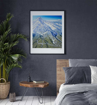
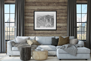
Ski trail map artwork can connect a mountain home to a favorite resort or regional landscape. Its mix of snowy terrain, forests, and distant peaks makes it both decorative and personal. Before ordering, check the current artwork options and dimensions against the space where it will hang.
The Man Behind the Maps combines the story of James Niehues with the history and techniques of hand-painted ski trail maps. It appeals to readers interested in mountain destinations as well as visual art and cartography. A print of a meaningful resort is another way to connect ski history with a specific place.
A resort guidebook typically helps plan a visit, while a book such as The Man Behind the Maps explores the art, history, and people behind ski-resort imagery. Its focus is the making and meaning of the paintings rather than current lift schedules or trail conditions.
A book about ski-map art or a print of a favorite resort offers something connected to skiing without duplicating equipment. The Man Behind the Maps tells the story behind familiar trail maps, while resort artwork can commemorate a particular mountain. Choose based on whether the recipient enjoys reading, displaying art, or both.
A map of a mountain associated with important trips or years of skiing can be a meaningful way to mark an occasion. James Niehues’s paintings preserve a recognizable visual impression of those places. Check the current catalog and shipping timetable before relying on a specific artwork for an event.
Trail maps are familiar objects that most skiers use without thinking about how they are made. The Man Behind the Maps reveals the creative decisions, technical work, and artistic history behind those images. It gives readers a new way to look at resorts they may have visited many times.