Deer Valley Ski Map
Each piece is printed using the highest-quality materials and printing methods:
- Paper type: 100% acid-free FSC - certified archival paper
- Paper thickness: 230gsm
- Printing: Canon 12 color giclee printing
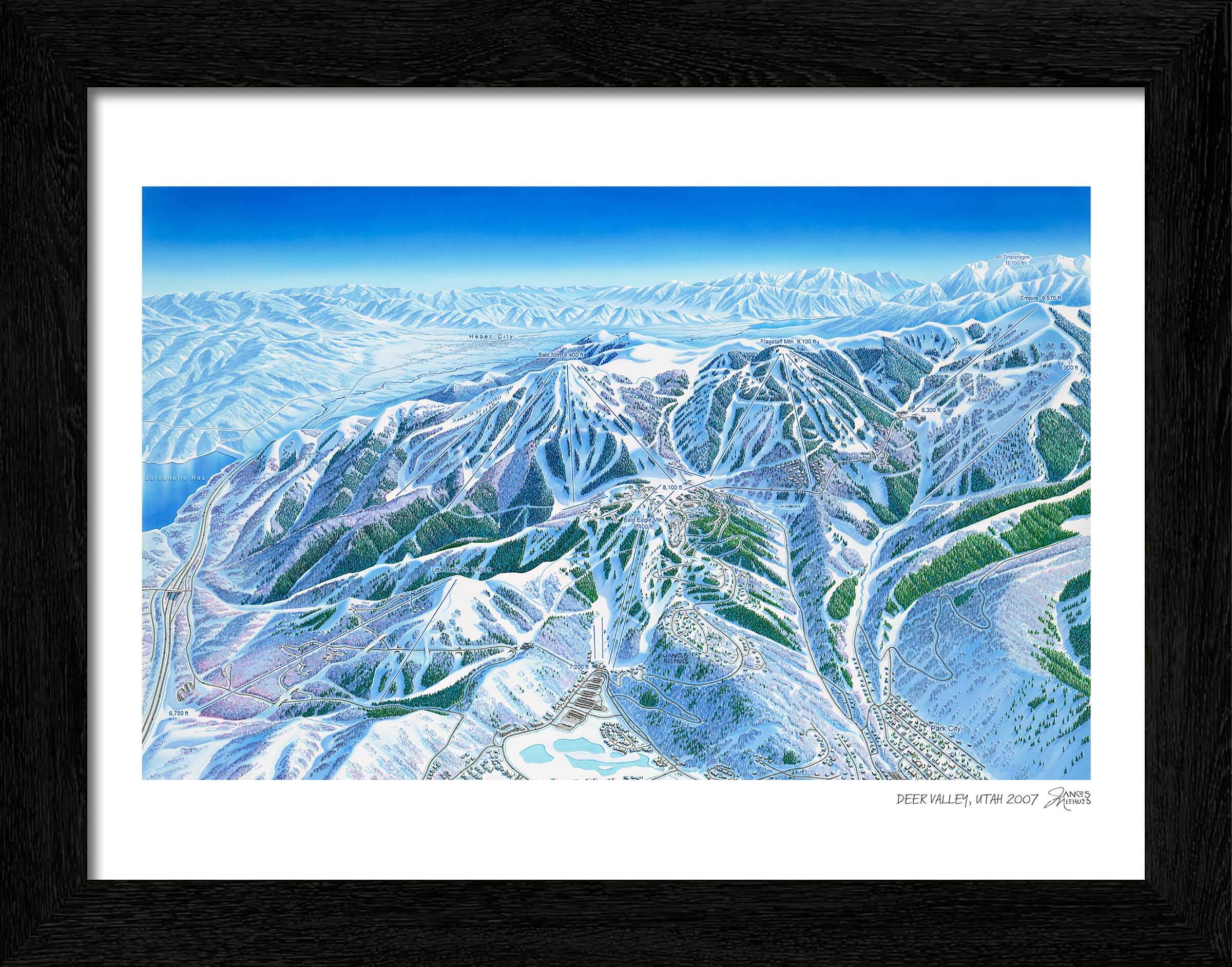
Framing
Our custom black wooden print frames feature a deep, squared profile to showcase Niehues’ timeless work. Frames feature a EV filtering non-glare acrylic front plus acid-free foamcore backing.
FRAME WIDTHS:
- All prints: 1-1/4" inches wide, 13/16" deep
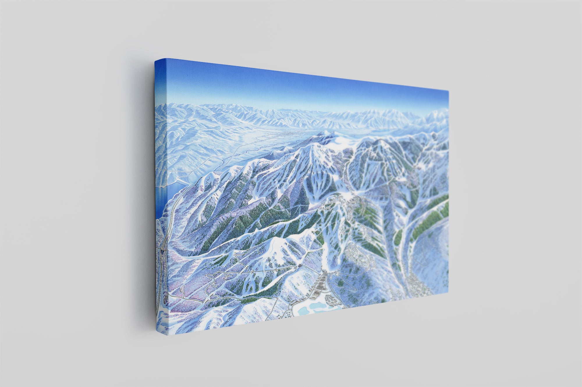
Canvas
Available as a large size gallery canvas. Each canvas is hand stretched over an internal frame and comes ready to hang with a pre-installed hanging wire.
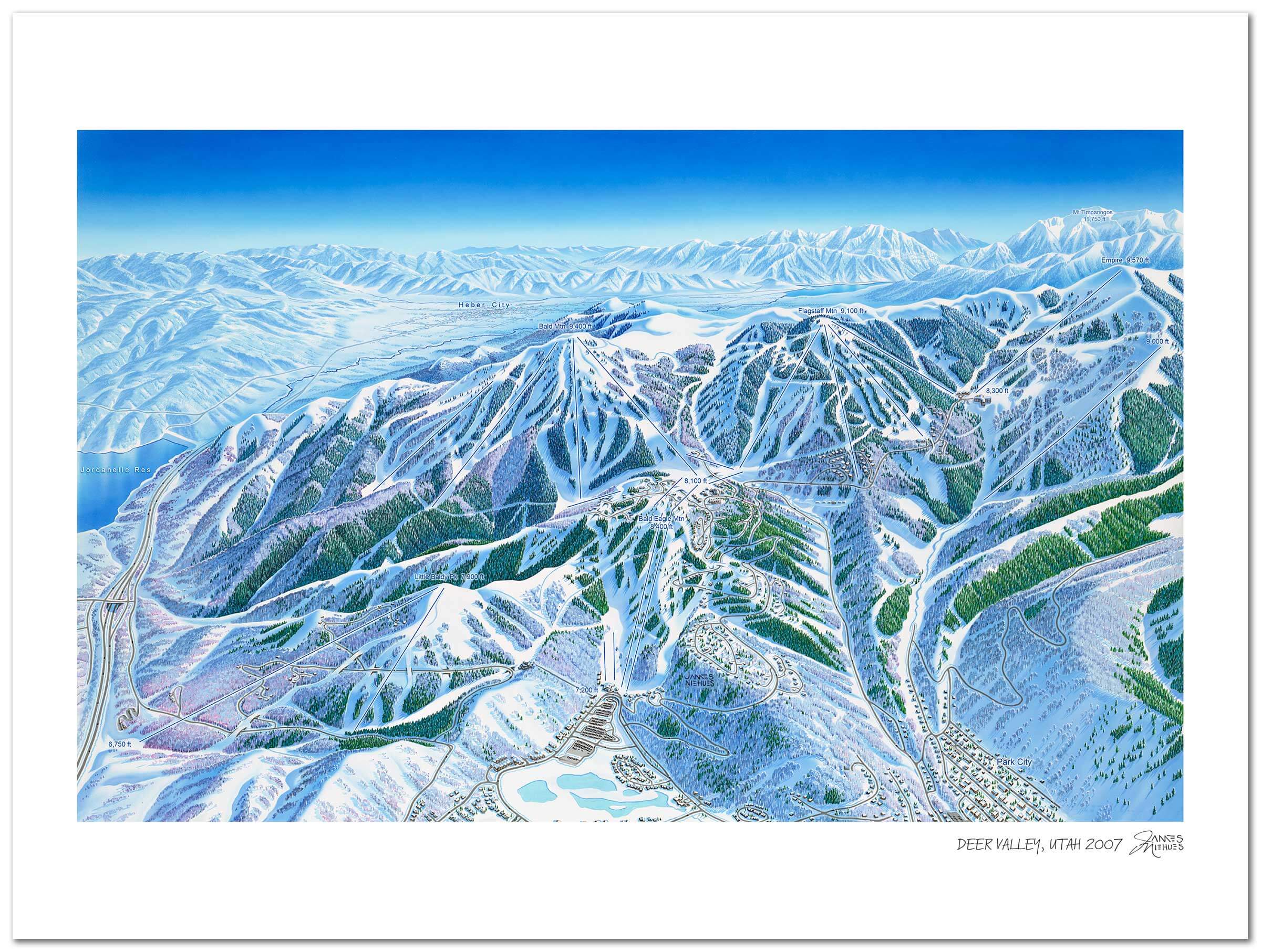
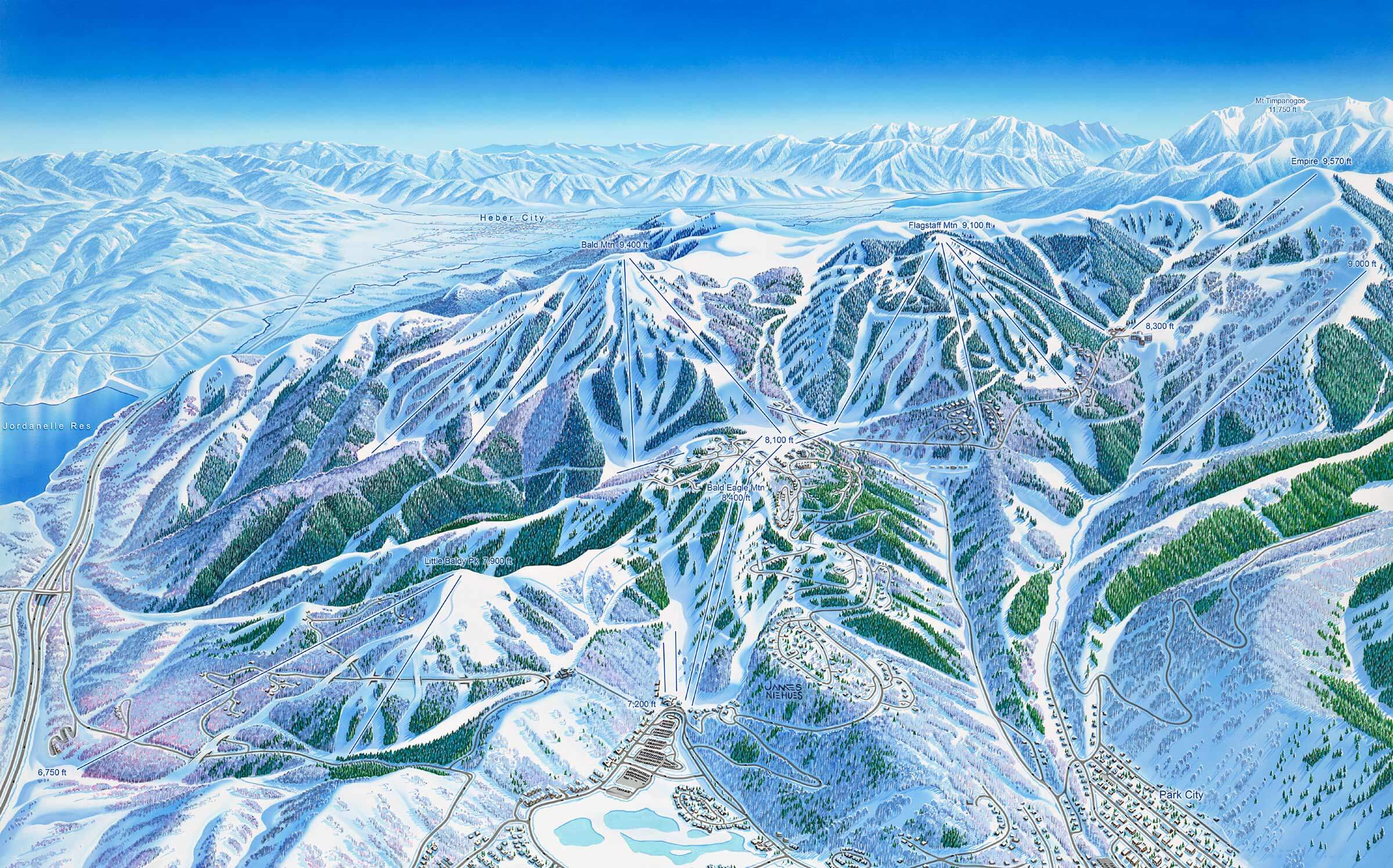
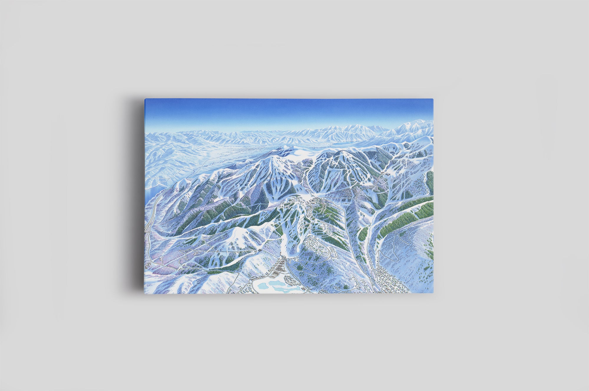
Deer Valley Ski Map Park City, Utah
Painted in 2007
Deer Valley has always had a little something extra going on, it’s never settled for being just a ski hill, instead, they’ve embraced the all-encompassing “resort” title in an effort to stand out from the crowd of other Utah resorts. And it’s worked. At Deer Valley, you truly can “ski the difference” every run. Their grooming is immaculate, and their network of lifts and runs makes it easy to explore the mountain at your own pace, while the extensive lodge facilities mean that your time spent off the hill will be just as fulfilling as every hour on the chairlifts. Deer Valley’s 24 lifts, including a gondola and 12 high-speed quads, whisk skiers around the mountain in comfort, while 2,000 acres of skiable terrain provides a lifetime’s worth of exploration.
Timeless art for your home
Each piece is printed using the highest-quality materials and printing methods:
- Paper type: 100% acid-free FSC-certified archival paper
- Paper thickness: 230gsm
- Printing: Canon 12 color giclee printing
Finishing touches
Framing
Our custom black wooden print frames feature a deep, squared profile to showcase Niehues’ timeless work. Frames feature a EV filtering non-glare acrylic front plus acid-free foamcore backing.
FRAME WIDTHS:
- All prints: 1-1/4" inches wide, 13/16" deep
Canvas
Available as a large size gallery canvas. Each canvas is hand stretched over an internal frame and comes ready to hang with a pre-installed hanging wire.
The legendary James Niehues
If you are a skier or snowboarder, there is a good chance James Niehues has been your mountain guide. Throughout his 30 year career he has worked at the smallest hills and the most expansive resorts in North America. He has left his mark in South America, Australia, Asia and Europe too. And even if you have never shared a bottomless powder day with him, he has always been close by.