Breckenridge Ski Map
Each piece is printed using the highest-quality materials and printing methods:
- Paper type: 100% acid-free FSC - certified archival paper
- Paper thickness: 230gsm
- Printing: Canon 12 color giclee printing
Framing
Our custom black wooden print frames feature a deep, squared profile to showcase Niehues’ timeless work. Frames feature a EV filtering non-glare acrylic front plus acid-free foamcore backing.
FRAME WIDTHS:
- All prints: 1-1/4" inches wide, 13/16" deep
Canvas
Available as a large size gallery canvas. Each canvas is hand stretched over an internal frame and comes ready to hang with a pre-installed hanging wire.
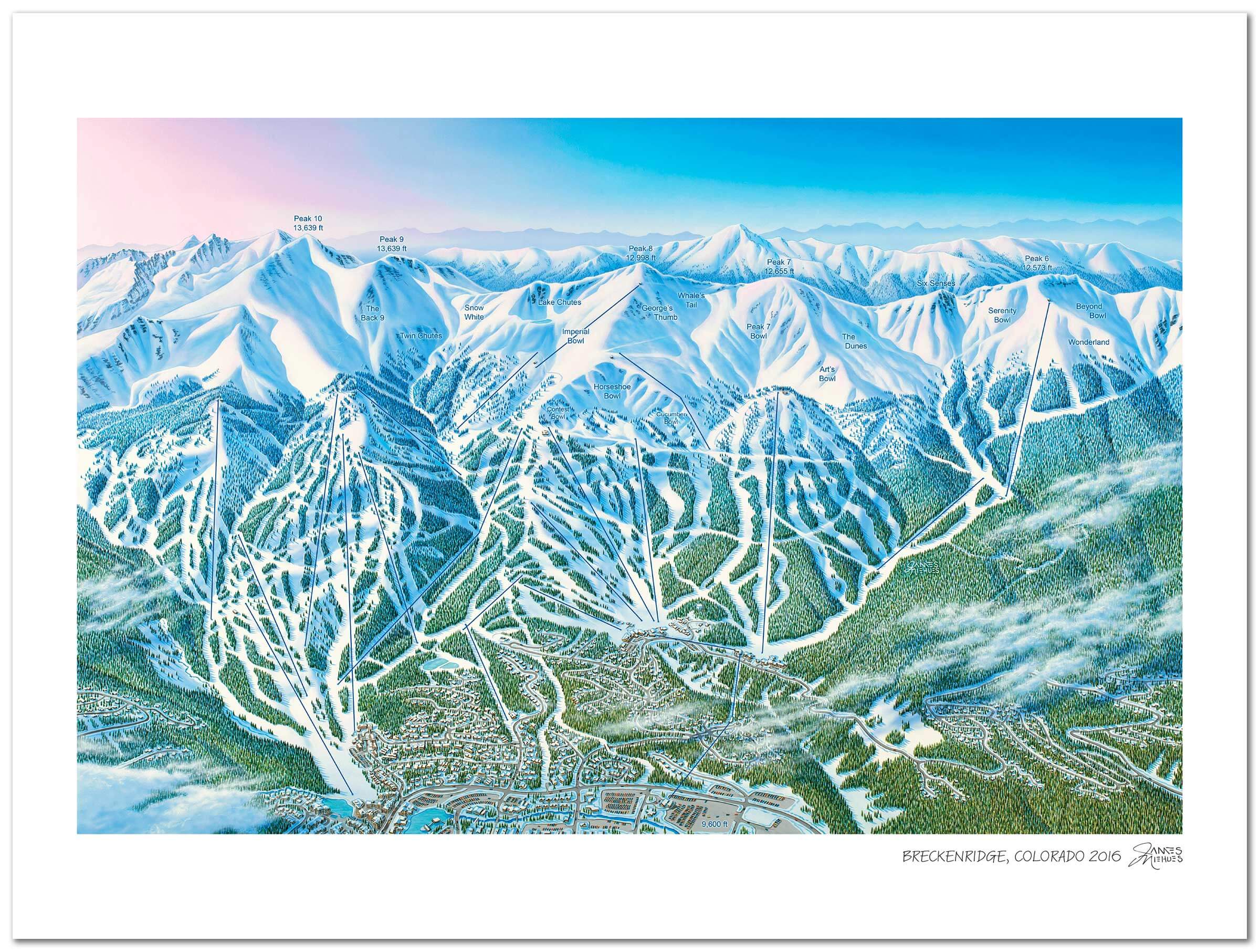
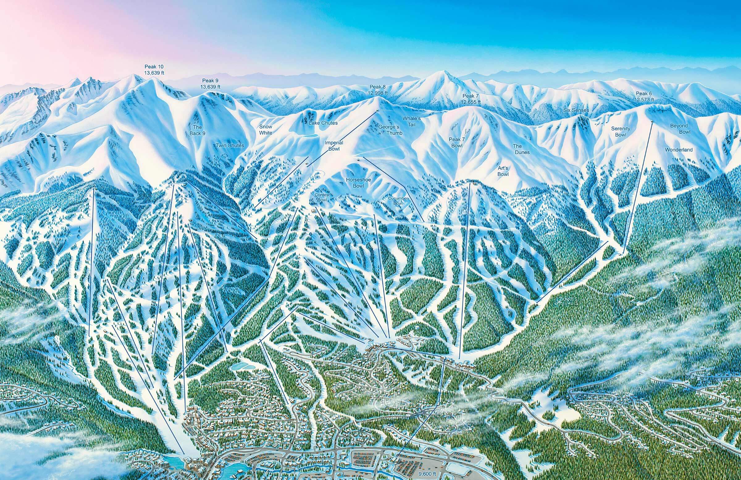
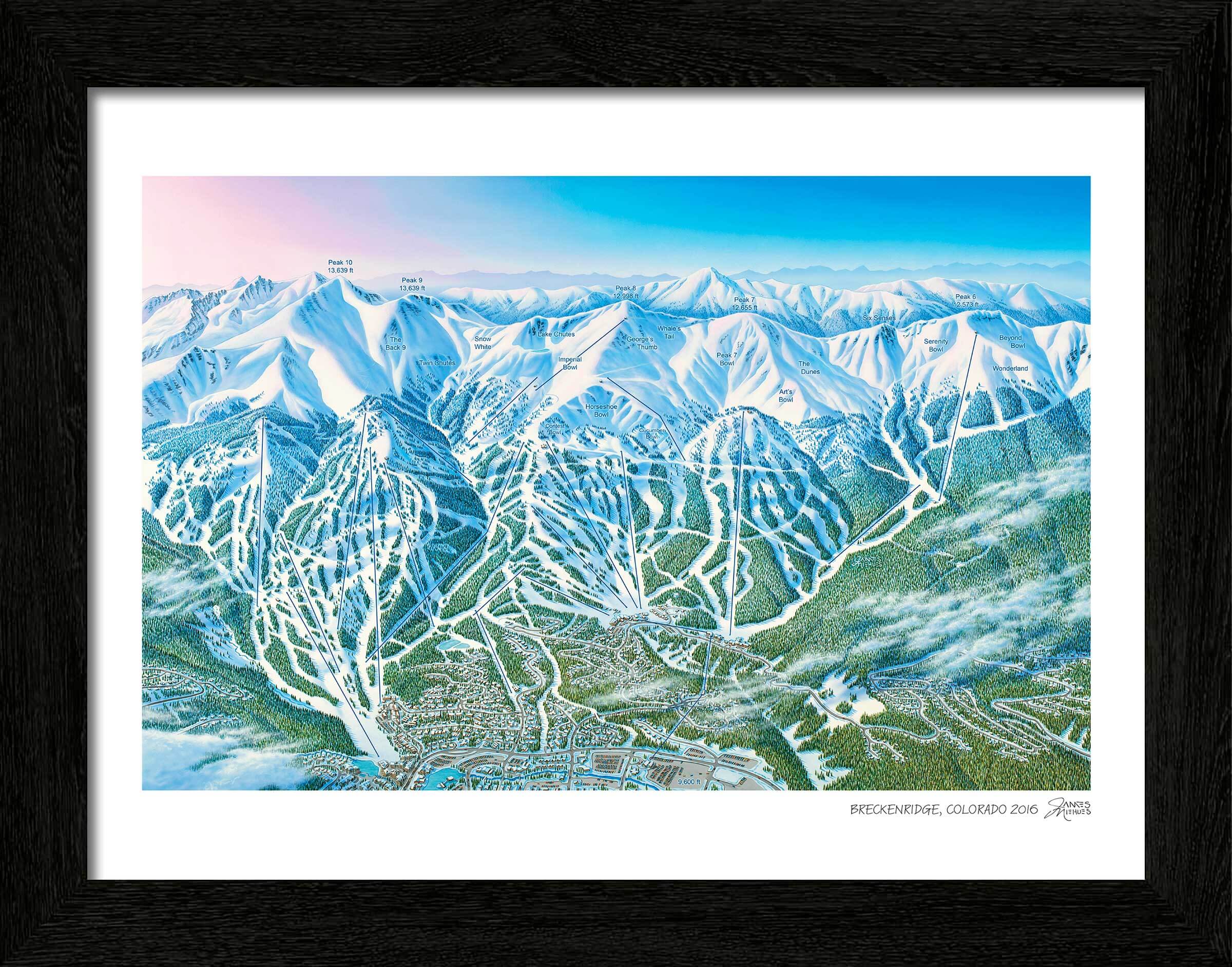
Breckenridge Ski Resort in Breckenridge, Colorado
Painted in 2016
For many skiers, the Colorado mountain experience isn’t complete without a few days at Breckenridge. It’s one of those resorts that’s definitive, it contains multitudes and draws everyone in with its unique combination of terrain, amenities, and culture. And plenty of that magic comes from Breckenridge’s unique climate. The mountain manages to average about 300 days of sun each year, while also getting about 300” of snow every winter. That combination is a recipe for a whole lot of bluebird pow days. It doesn’t hurt that Breckenridge is a hot spot for freestyle skiing and snowboarding as well. It was the first resort in Colorado to allow snowboarding, and that legacy holds, as Breck maintains world-class terrain parks.
Timeless art for your home
Each piece is printed using the highest-quality materials and printing methods:
- Paper type: 100% acid-free FSC-certified archival paper
- Paper thickness: 230gsm
- Printing: Canon 12 color giclee printing
Finishing touches
Framing
Our custom black wooden print frames feature a deep, squared profile to showcase Niehues’ timeless work. Frames feature a EV filtering non-glare acrylic front plus acid-free foamcore backing.
FRAME WIDTHS:
- All prints: 1-1/4" inches wide, 13/16" deep
Canvas
Available as a large size gallery canvas. Each canvas is hand stretched over an internal frame and comes ready to hang with a pre-installed hanging wire.
The legendary James Niehues
If you are a skier or snowboarder, there is a good chance James Niehues has been your mountain guide. Throughout his 30 year career he has worked at the smallest hills and the most expansive resorts in North America. He has left his mark in South America, Australia, Asia and Europe too. And even if you have never shared a bottomless powder day with him, he has always been close by.